

Smart cities provide their residents with more efficient services while saving resources and being environmental-friendly. Service provision is based on data that is analyzed to provide a higher quality of life to citizens based on their characteristics: age, gender, financial status, personal requirements, and more. Services include traffic management, crime protection, resourceful waste disposal, and more. With connected car data, municipalities and governmental entities and organizations can provide such advanced services to drivers, passengers, and pedestrians.
Today, cities cannot afford to overlook automotive data as an important layer for city management. Here are 5 ways vehicle data can be added to municipal systems and be used for good: to help design driver services and improve quality of life.
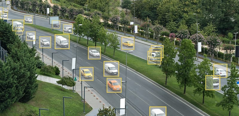
1. Traffic light tuning and management
Automotive data attributes can indicate driver trips and routes while monitoring congestion and slowdowns. By analyzing traffic jams or slower traffic than normal in real-time, cities can tune traffic lights in real-time. Thus, they can reduce driver stalling and bring it to a minimum. This will make drivers much happier on the way to work and on their way back home. Read more from this blog post.
In addition, it will save the economy money. Congestion induces lost work and leisure hours, impairs the mental health of individuals and increases air pollution. These amount to billions of dollars a year for big and small economies.
As a more advanced solution, a green-light-guidance service could be developed for drivers. By using cameras like Mobileye, data enables identifying where the lights are green and traffic is flowing. Navigation apps can implement this new layer of car data into their systems and direct drivers through efficient routes.
2. Parking management
Parking is a driver point in urban areas. Drivers struggle to find parking locations and the payment process is often awkward or time-consuming. Municipalities or parking services can use vehicle data attributes to develop solutions to these problems.
Location data, speed, ignition on/off and more can help to identify available parking spots according to different restrictions, e.g free parking for city residents, parking duration limitation and more. In addition, payment can be processed through such services, either through an app or even the car itself.
3. Road maintenance and safety
Hazardous roads are inconvenient at best, and life-threatening at worst. Due to high usage, concrete abrasion is common, resulting in cracks, potholes, bumps, slippery areas, and more. Maintenance of roads and sidewalks is so important, that officials need as much help as they can get.
Car data can identify the problems in the roads as well as dangerous sections by analyzing data such as braking, acceleration, curving or accident codes. Then, they can quickly send a team to the field to fix it. Car data can save lives.
4. Increasing Electric Vehicle adoption
Electric vehicles (Evs) are environmental-friendly, less expensive and require less maintenance. However, due to range anxiety, i.e the fear the driver will have nowhere to charge the vehicle, EV adoption is hindering.
Cities and governments can assist with this conundrum by using car data to build or assist building charging infrastructure. First, car data attributes like location, timestamp, state of charge (SOC), ignition on/off, odometer, distance, model, temperature and battery capacity enable analyzing driving patterns. Using these insights, optimal charging station locations can be identified and placed.
Over time, this ongoing vehicle data can be used to manage usage – either by determining which charging stations need backup and which can be shut down, or by guiding drivers via an app to available charging stations to increase mobility. From an infrastructure level, this vehicle data can be used to understand charging points’ influence on the power grid. Read more from this blog post.
5. Navigation and traffic analysis
Once upon a time, we pulled out a paper map anytime we wanted to get from point A to B. Today, mobile apps or in-car GPS services assist us, making our lives easier and reducing many miles of driving around lost.
Such mapping services can benefit from an additional layer of vehicle data. By incorporating car data like location, speed, road signs, and more, maps can provide even more accurate navigation information. This data can also help maps with flexibility. Data and information such as temporary signs, congestion, hazards and prediction analysis can be added. Then, guidance can be based not on past, static patters, but on real-time events and future predictions; thus, reducing congestion, driver stress, and time spent on the roads.
Download our road sign datasheet to learn more.
Make smart cities smarter with Otonomo
Otonomo offers multiple vehicle data attributes that can be added as a new, powerful layer for improving traffic management and creating smarter cities.
Contact us and get data attributes like odometer, road hazards, ignition on/off, accelerometer, crash data, and more. Sample data now.


