
By Anders Truelsen
Last month I had an opportunity to speak during MOVE London about how upgrading traffic management systems with multi-layered connected vehicle data can help cities keep traffic flowing and lower congestion. This talk raised a lot of interest and discussion and so I am happy to share with you my thoughts on the matter and keep the conversation going.
A City’s Pulse Is Its Traffic
The title of the blog is “Traffic is the heartbeat of the city” and without taking this analogy too far, it is safe to say that traffic does reflect the city’s lifeblood. Where traffic flows, so does commerce, services, jobs and city life itself.
Nowhere is this felt more strongly than when traffic stops. When traffic stops, so does the city. Suddenly nothing moves when there is a gridlock. You may have felt it coming into the office today, but this is more than just an inconvenience. Emergency first responders can’t respond if the city is clogged, nor can municipal services, like garbage disposal or city repairs, be provided. A city one cannot enter means less shoppers can get into stores and the list goes on.
On the city level, this problem is compounded when hundreds of thousands of residents all try to get from one place to another, combining to erode infrastructure and create safety issues, increase wear on vehicles and induce anxiety, stress and road rage. The result is reduced productivity and financial losses due to work hours spent in extended commutes as well as environmental damage cause by increased air pollution and carbon dioxide levels

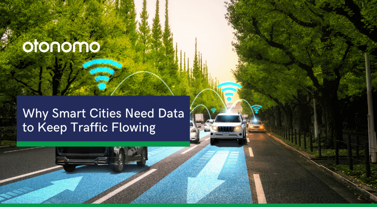
Data Is the Key to a Smart City
Smart cities try to use data to ease congestion, but not all data is the same. Data collected using traditional sources like cameras, road sensors and people standing on the corner counting cars is expensive, inaccurate, and limited. Yes, some so-called smart cities do rely on people wearing bright vests and clicking a counter to measure traffic. A recent survey Otonomo conducted among US cities showed many municipalities and transportation departments are still using these traditional methods of data collecting.
Even a relatively advanced option like a street camera is amazingly inefficient. It is expensive to purchase, install, maintain, offers limited coverage – and is not deployed on every street, susceptible to lost accuracy during heavy storms or fog, provides only limited data – typically speed and location, and requires maintenance. In addition, driver and passenger privacy issues are raised as consent has not been given for images to be taken.
Leveraging Vehicles as Sensors on Wheels and Enriching Data from Other Sources
The solution lies in implementing connected, multi layered vehicle data and mobility intelligence. A synergy achieved from merging many layers and types of data and actionable insights. This can:
- Improve traffic routing and reduce congestion
- Boost safety and prevent accidents
- Expedite first responder’s emergency response
- Alleviate parking problems
- Improve driving experience
- Achieve more accurate predictions and travel time estimations
- And enable more effective infrastructure planning
It is important to remember that the traffic is not generated by motorized vehicles alone, and access to other types of mobility solutions creates a more accurate multi-modal transportation picture. One that includes data from electric scooters and e-bikes, busses, emergency vehicles, construction equipment and more.
Therefore, in order to really become a smart city, the city needs to ensure access to a variety of different data types and sources. Moreover, data needs to be received in real- or near-real time to make smart, impactful decisions.
Modern vehicles provide a warehouse of sensors providing rich accurate data on multiple variables they can provide weather data, road friction data, sign data, data about car speed and heading and much, much more. Having access to such a variety of different data types helps cities make much smarter decisions, and provides fodder for AI, ML and mobility intelligence.

6 Sensors You Didn’t Even Know You Had
Vehicle data is a powerful tool and includes many sensors smart city planners are unaware of. For example, cars are equipped with cameras that can “read” road signs, for a city accessing this data can also serve as an alert for when the sign is missing for some reason (Maybe it was blown down by a storm or knocked down in an accident) and remedying the situation.
Here are some more use cases for what vehicle data can achieve for a smart city:
- Real-time weather data can be used to warn drivers of upcoming road conditions to avoid accidents and more accurately predict weather-related accident locations. Based on accident prediction, medical care and accident scene cleanup can be expedited to save lives, reduce consequent congestion and avoid secondary incidents. Additionally micro-climates can be found in the city and addressed.
- Real-time hazard data can be employed to warn drivers on upcoming breakdown events and speed up response to clear the road. A quick response will ease subsequent congestion, prevent resulting incidents and increase drivers’ safety
- Real-time parking data can be utilized to map parking spots and generate parking statistics that improves parking availability, which in turn will reduce cruising for parking and the resultant congestion and emissions
- Historical & real-time EV data can support EV charging site planning and optimization to reduce range anxiety and make EV ownership more convenient. More accurate prediction of crowded charging periods can facilitate load management and flexible charging rates planning and improve charging experience.
- Real-time construction equipment data can ease congestion and increase safety by informing mapping services and drivers on closed or construction affected roads, so traffic can be rerouted to alternative roads
- Real-time road friction data can provide insights on the conditions of the road surface to warn drivers on the status of the road ahead and alert on required road work. With friction data, preemptive maintenance can be implemented as well as using smart signage to steer drivers away from dangerous roads.
Data Diversity Is Key to Urban Mobility
Smarter, deeper, and richer data leads to better insights that are used to alleviate bottlenecks, increase safety, and reduce emissions. Having access to rich multi-layered vehicle data coupled with powerful mobility intelligence also means your city can be better prepared for severe weather events, can react in real time to the congestion around construction sites, reduce cruising for parking and provide greater visibility to events on the road.
Having access to multiple types of data helps city decision makers make their cities safer and considerably less stressful as well as contribute to the local economy. They can react quickly to unforeseen events on the road, such as car breakdown or accidents, and mitigate their ripple effects.
They are better prepared for severe weather conditions that may include heavy rain, fog, ice, snow, and dust, and have a significant impact on traffic operations, traffic flow and road safety. A data driven city can reduce cruising for parking that creates a moving queue of cars that are waiting for parking vacancy and slows down the entire traffic lane. And it can better handle construction projects that are a vital part of every urbanization process, but have a significant effect on traffic, leading to increased congestion and delay during the construction period. In the city of Hamburg for example, more than 3,000 construction projects affected the roads during 2019, bringing great misery to drivers and commuters.
Legal And Practical Concerns
When running a smart city, it is also of vital importance to make sure you are compliant with all the relevant regulations as well as within budget. This is another advantage of using connected vehicle data. Vehicle Data is received only after driver consent has been given and is compliant with the privacy regulation (supporting both GDRP and CCPA among others). It is also hardware free, requiring little to no upfront investment or complicated ongoing logistics and maintenance.
Smarter data means safer roads. Safer roads save lives. Those lives are yours, mine and our children’s.
Feel free to reach out and continue the conversation or talk to one of our data experts.